Caribbean
Caribbean Ports: ° Anguilla ° Antigua and Barbuda ° Antilles ° Aruba ° Bahamas ° Barbados ° Cuba ° Dominica ° Dominican Republic (Santo Domingo) ° Grenadines ° Guadeloupe ° Haiti ° Jamaica ° Martinique ° Netherlands/Antilles ° Puerto Rico ° Saint Kitts ° St. Lucia ° St. Martin ° St. Thomas ° St. Vincent and the Grenadines ° Tortola ° Trinidad and Tobago ° Turks and Caicos
Saint Thomas
Tortola, and Virgin Gorda are the four main islands of the US Virgin Islands and British Virgin Islands, but there are hundreds of islands, cays and some that are not much more than large above-the-water rocks; many uninhabited.
The first residents of the present United States Virgin Islands (USVI) were the Ciboney, Caribs, and Arawaks.

In 1493, Christopher Columbus visited these islands. He had been searching for a route to India and consequently he called the people he encountered Indians. Columbus named the beautiful islands "The Virgins" in reference to the legendary beauty of St. Ursula and her 11,000 virgins. (Image: Trunk Bay, Virgin Islands.)
In the early 1600s many countries took interest in the Caribbean and in "the Virgins"; Holland, France, England, Spain, Denmark and the Knights of Malta all sought colonies. England and Holland colonized and jointly inhabited St. Croix in the 1620s. The neighboring Spanish on Puerto Rico invaded the small colony; the French then quickly moved in, removing the Spanish and taking over themselves. St. Croix remained a French colony until 1733.

The Virgin Islands were settled by the Dutch in 1648 and then annexed by the English in 1672.
The Danish had claimed St. John as early as the 1680's, however hostility from the neighboring British on Tortola prevented the Danes from establishing a settlement. In 1685, the Danish government signed a treaty with the Dutch of Brandenburg. This treaty allowed the Brandenburg American Company to establish a slave-trading post on St. Thomas.

Early governors also approved of St. Thomas becoming a pirates' safe haven. The governors realized an influx of pirates would benefit local merchants. While piracy ceased to be a factor in the island's economy in the early 1800s, the slave trade continued.
In the Danish West Indies slaves labored mainly on sugar plantations. Cotton, indigo and other crops were also grown. Sugar mills and plantations dotted the islands hilly landscapes. Sugarcane, produced by slave labor, drove the islands' economy during the 18th and early 19th centuries.
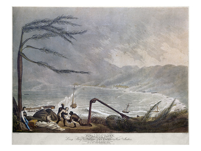 |
St. Thomas: San Felipe Hurricane, 1819 View of Long Bay from Havensight Point |
Each island's economy prospered through sugar plantations and slave trading. While St. John and St. Croix maintained a plantation economy, St. Thomas developed into a prosperous center of trade. Slave rebellion on St. John and St. Croix are well documented. Legitimate trade and business on St. Thomas influenced a different society where many more slaves were given freedom and an opportunity outside of plantation life.
A July 2, 1848 rebellion on St. Croix, where some 5,000 blacks were free while another 17,000 remained enslaved, prompted liberal governor Peter von Scholten to declare what he had long pressed for, that all unfree in the Danish West Indies were from that day free. While his proclamation was in direct contradiction of the King's orders and while plantation owners refused to accept the proclamation, slavery was abolished on July 3rd, 1848.
September 7, 1883, The Gleaner, Kingston, Jamaica
St. Thomas, Sept. 5th--A cyclone is reported to have passed over Martinique during Wednesday night, seven large vessels, steamer and numbers of small craft and wharves totally destroyed; loss of life not yet known. The cyclone appears to have passed to the south of Saint Kitts and Saint Croix, considerable damage to shipping at former place.
October 26, 1898, Albert Lea Freeborn County Standard, October 26, 1898, Albert Lea, Minnesota, U.S.A.
The Virgin Islands
A Field for the Photographer and the Scientist as Well
Least Known and Fairest of the Caribbean Islands -
Pathetic Ruin Amid Most Magnificent Scenery.
(Special Kingston, Jamaica Letter.)

The Americanization of the Spanish West Indies in the near future cannot fail to bring the entire chain of the Antilles, both the Greater and the Lesser, under the immediate notice of the people of the United States. Of late years the various tourist syndicates have done a great deal in this direction, but their attentions have been necessarily confined to those of the larger and more important islands where some sort of hotel accommodations may be counted on.
These islands, however, by no means monopolize the palm for romantic tropical scenery or of the interest of antiquity as antiquity goes in this part of the world. Indeed, from an artistic point of view, the palm easily rests with the smaller islands, where the elevations are more apparent in the perspective and the tendency is toward a grouping together, for all the world as though the formation of the whole wonderful island chain had been determined by the law that governs the movement of solid fragments on a liquid surface.
And, regarded in this light, there is no other section of the West Indies more calculated to awaken human sympathies by a display of pathetic decadence and ruin side by side with the most superb exhibitions of panoramic loveliness than the compact little archipelago of the Virgin islands, extending northeasterly from Vieque or Crab island, off the eastern point of Puerto Rico, to Anegada on the borders of the Atlantic, and which includes on its outskirts the well-known island of St. Thomas. If, besides a wide and rich field for American enterprise, it is a veritable fairy land that the late war has brought within the notice of the American people, this little group of of islands may very well be regarded as its penetralia; and for this reason a brief description of them may prove of timely interest.

With the exception of Tortola, St. Thomas and St. Croix, if the latter can be fairly included, neither of which is, however, of any size, the islands are so small as to amount to little more than islets or quays. But what they lack longitudinally they for the most part make up vertically. Of volcanic origin whether of subsidence or upheaval being a moot point they rise sheer from the bed of the sea, reaching up to several hundred, and sometimes over a thousand feet above sea level, presenting broken and diversified surfaces covered with rich soil that supports abundant tropical vegetation in some instances, whilst elsewhere a coral formation prevails and the soil is highly arenaceous, supporting nothing but cocoanut palms and cacti.
Geography books state that there are 50 "Virgins," all told; that, however, may be taken not only as a "round," but a rather fancy number; for whilst they are numerous enough, and as bewildering as a Chinese puzzle to sail amongst, the admiralty chart shows scarcely 40, including rocks and naked shoals, and the islands worthy the name, as supporting populations, may be counted on the fingers of one hand, if we exclude the Danish colonies of St. Thomas and St. John.

In 1628 the islands were home to pirates. Blue Beard and Black Beard lorded it in St. Thomas; and their rival and sworn foe, Jose van Dyke, reigned in Tortola.
International rights were rather loosely observed; nations, such as England and Spain funded pirates.
The islands really belonged to Spain, but as she could not deal with these nests of pirates England and Denmark set about doing it for her and, driving out the pirates, hoisted their respective flags and took possession. Tortola proved a rich acquisition for England, being a first-class sugar island in those days of high prices and slave labor, and it soon became a flourishing colony, whilst its neighbor, St. Thomas, with its matchless harbor, although economically worthless, became the entrepot of the Lesser Antilles and a rival of Port Royal.

The subsequent history of these islands is that of the West Indies. Only, perhaps, that their decadence and rum has been both more precipitate and more complete. Tortola has not even the shadow wherewith to console its spirit. Of all the once fair and flourishing plantations that made the little island one continuous garden of economical vegetation "from the center all round to the sea," not one remains. The hand of decay has been laid heavily on the land, and the shadow of desolation covers it as a cloud.
Fields are covered by forests at least a quarter of a century old; the jungle has invaded formerly populous villages; and even in the capital, Road Town, the halls of the once opulent colonists are crumbling ruins and eloquent witnesses to the speedy triumph of nature over the works of man in the tropics. From 30,000 the population has dwindled to scarce as many hundreds.
This utter ruin is partly due to economic causes, but more immediately so to the terrific seismic visitation of 1867 above mentioned incidentally. That, to a great extent, changed the very face of the islands, leaving great trails behind that can be seen to this day the earth coverings of mountains swept into the sea here, leaving the gaunt rugged rock bare, and the very bowels of others collapsing there, leaving vast and repulsive crater-like chasms where even tropical vegetation refuses to grow. And the springs were all dried up, so that aridness has succeeded fertility.
But the Virgin islands are yet a veritable fairyland of scenic beauty. This perhaps goes without saying, when one gives thought to the panoramic possibilities of those varying combinations of sea and landscapes that must appertain to such a group. Tortola and Virgin Gorda, as the loftiest, present the finest and most extensive prospects; and possibly nowhere else can be found quite so magnificent a panorama of land and sea as that seen from the heights behind Road harbor at sunrise, looking through the mouth of the harbor to the island chain beyond. Here, during the phenomenon of sunrise, literally all the possible lights and shades of nature are seen marching in gorgeous procession overland and sea, to which superb display both elements lend themselves in a perfect gamut of perspective gradations if I may so describe it. Three to five hundred feet higher and the spectator has the entire panorama of the Virgins spread out before, behind and on either hand. Here is a field, at least, for the enterprising photographic fiend who is today tramping to the ends of the earth for "subjects."

Another interesting, and far more important, feature of the Virgin islands that must be here noticed, but which it would require an exclusive letter (and more) to deal with exhaustively, is the thermal and medicinal springs that seem according to the accounts of- the natives to have come into existence after the great earthquakes. So far as I am aware, they have not been scientifically investigated. They certainly were not up to 1885 when I visited the islands. The natives claim that these "nasty waters," used both externally and internally, have, in their experience, wrought miraculous cures for all sorts of ailments to which tropical flesh is heir; notably rheumatism, malarial pains, sprains, toothache, etc., bowel complaints, shortness of breath, sore, eyes and a dozen other troubles that I do not now remember. I do remember, however, that one of the pools (on Ginger island) completely cured me in three days of muscular contraction of the leg caused by a wound, and which had for six months defied liniments. Here is a field not unworthy-the notice of the scientific investigator, I should think.
The point is, that these interesting islands sit right outside the back door of the United States' new colonial acquisition, Puerto Rico, where they can be leisurely "done'' by anyone so minded at trifling cost and little trouble.
T. P. PORTER
1899. World's Fleet. Boston Daily Globe
Lloyds Register of Shipping gives the entire fleet of the world as 28,180 steamers and sailing vessels, with a total tonnage of 27,673,628, of which 39 perent are British.
| Great Britain | 10,990 vessels, total tonnage of 10,792,714 |
| United States | 3,010 vessels, total tonnage of 2,405,887 |
| Norway | 2,528 vessels, tonnage of 1,604,230 |
| Germany | 1,676 vessels, with a tonnage of 2,453,334, in which are included her particularly large ships. |
| Sweden | 1,408 vessels with a tonnage of 643, 527 |
| Italy | 1,150 vessels |
| France | 1,182 vessels |
For Historical Comparison
Top 10 Maritime Nations Ranked by Value (2017)
| Country | # of Vessels | Gross Tonnage (m) |
Total Value (USDbn) |
|
|---|---|---|---|---|
| 1 | Greece | 4,453 | 206.47 | $88.0 |
| 2 | Japan | 4,317 | 150.26 | $79.8 |
| 3 | China | 4,938 | 159.71 | $71.7 |
| 4 | USA | 2,399 | 55.92 | $46.5 |
| 5 | Singapore | 2,662 | 64.03 | $41.7 |
| 6 | Norway | 1,668 | 39.68 | $41.1 |
| 7 | Germany | 2,923 | 81.17 | $30.3 |
| 8 | UK | 883 | 28.78 | $24.3 |
| 9 | Denmark | 1,040 | 36.17 | $23.4 |
| 10 | South Korea | 1,484 | 49.88 | $20.1 |
| Total | 26,767 | 87.21 | $466.9 | |

Site Search


A History of the West Indies: Containing the Natural, Civil and Ecclesiastical History of Each Island
1st Edition.
Reverend Thomas Coke.

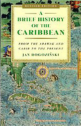
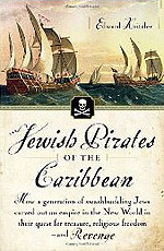
A Brief History of the Caribbean: From the Arawak and Carib to the Present
The Sugar Barons: Family, Corruption, Empire, and War in the West Indies
Matthew Parker.

The Chinese in the West Indies, 1806-1995: A Documentary History

To Hell or Barbados: The Ethnic Cleansing of Ireland.
Sean O'Callaghan
More than 50,000 Irish men, women and children were transported to Barbados and Virginia. Sean O'Callaghan documents the history of these people: their transportation, the conditions in which they lived on plantations as slaves or servants, and their rebellions in Barbados. An illuminating insight into a painful episode in Irish history, but its significance is much broader than that. Its main achievement is to situate the story of colonialism in Ireland in the much larger context of worldwide European imperialism. O'Callaghan's description of seventeenth century Barbados is a powerful portrait of a society as brutal, corrupt and unjust as anything the twentieth century has to offer. A valuable book.""--Irish World

The Caribbean: A History of the Region and Its Peoples
Stephan Palmie, Francisco A. Scarano, Editors.

A Brief History of the Caribbean: From the Arawak and Carib to the Present