VIPs

Aaron Arrowsmith
Born: July 14, 1750, Winston, County Durham, England.
Died: 1823.
English cartographer and geographer. Founder of the Arrowsmith family of geographers.
There is no indication that Aaron Arrowsmith -- or any of his family of cartographers -- reached any of the Americas; however his skills were used to exquisitely map the world possibly from earlier charts and illustrations from earlier explorers.
He moved to Soho Square, London at about age 20 and was employed by John Cary, the engraver and William Faden.
He became hydrographer to the Prince of Wales around 1810 and subsequently to the King in 1820.
He was also one of the founders of the Royal Geographic Society and author of "A Geographical Dictionary of the Holy Scriptures: Including Notices of the Chief Places and People Mentioned in the Apocrypha."
Without a formal education, after working as a surveyor, Aaron Arrowsmith established himself as a mapmaker and publisher.
His large world map (1790) established his reputation. A second such map published in 1794 was accompanied by an explanatory volume. Other notable works included a map of North America (1796), a chart of the Pacific Ocean (1798), and his Atlas of South India (1822). (Above: Map of the world, researches of Captain James Cook, 1808.)
>Many other world illustrations from the early 1800s of similar quality and from the Arrowsmith family, including Aaron Arrowsmith, are now being made available by companies such as Amazon:Aaron Arrowsmith Maps.
After Arrowsmith's death, the business was carried on by his sons, Aaron and Samuel, who published geography manuals and a number of atlase, including the Eton Comparative Atlas, a Biblical atlas, and of various manuals of geography.

From 1839 the business was conducted by his nephew, John Arrowsmith (1790-1873), nephew of the elder Aaron.
In 1821, they published a more complete North American map from a combination of maps obained from the Hudson's Bay Company and Aaron's previous map.
The London Atlas 4 vol. (1834), the best set of maps then in existence, was followed by a long series of elaborate and carefully executed maps embodying the results of contemporary exploration. The maps of Australia, North America, Africa, and India were especially valuable.
Maps published include:
- Asia Minor, 1812, Aaron Arrowsmith
- Chart of the world on Mercator's projection, exhibiting all the new discoveries to the present time: with the tracks of the most distinguished navigators since the year 1700, carefully collected from the best charts, maps, voyages, &c extant. , 1790 (8 sheets)
- A Map Exhibiting All the New Discoveries in the Interior Parts of North America, 1 January 1795 (Other editions 1801, 1802, 1804 and 1816 featuring roads)
- Hindoostan, 1812. Aaron Arrowsmith
- Chart of the South Pacific, 1798
- A New Map of Africa, 1802
- Chart Of The West Indies And Spanish Dominions In North America, 1803 (4 sheets)
- South America, 1814, Aaron Arrowsmith
- A New Map of Mexico and Adjacent Provinces Compiled from Original Documents., 1810 (4 sheets)
- Map of Countries Round the North Pole, 1818
- Ogden map (North America), 1821 (2nd edition : 1834)
The Mapmakers: Revised Edition
John Noble Wilford

The Fourth Part of the World: An Astonishing Epic of Global Discovery, Imperial Ambition, and the Birth of America
Old maps lead you to strange and unexpected places, and none does so more ineluctably than the subject of this book: the giant, beguiling Waldseemuller world map of 1507." So begins this story of the map that gave America its name. For millennia Europeans believed that the world consisted of three parts: Europe, Africa, and Asia. They drew the three continents in countless shapes and sizes on their maps, but occasionally they hinted at the existence of a "fourth part of the world," a mysterious, inaccessible place, separated from the rest by a vast expanse of ocean. It was a land of myth?until 1507, that is, when Martin Waldseem?ller and Matthias Ringmann, two obscure scholars working in the mountains of eastern France, made it real. Columbus had died the year before convinced that he had sailed to Asia, but Waldseem?ller and Ringmann, after reading about the Atlantic discoveries of Columbus's contemporary Amerigo Vespucci, came to a startling conclusion: Vespucci had reached the fourth part of the world. To celebrate his achievement, Waldseemller and Ringmann printed a huge map, for the first time showing the New World surrounded by water and distinct from Asia, and in Vespucci’s honor they gave this New World a name: America.

The Mapmaker's Eye:David Thompson on the Columbia Plateau
Jack Nisbet
David Thompson was a fur trader, explorer, and meticulous geographic surveyor. He was the English and Canadian counterpart of Lewis and Clark. He visited the Mandan villages on the Missouri River in 1798. He crossed the Continental Divide in 1807 and spent five winters on the west side of the divide trading with the Indians. He explored the Columbia River from its origin to the Pacific Ocean. He kept complete journals. He was a better writer than Meriwether Lewis, although not Lewis' equal as a naturalist. He took astronomical readings and did his own computations of both latitude and longitude. Because of this, his maps were much more accurate than those of William Clark. Later in his life, Thompson helped survey the boundary between Canada and the United States.


Site Search
A History Of California Newspapers, 1846-1858
Edward Cleveland Kemble
The Annals of San Francisco
Frank Soule, John H. Gihon, James Nisbet
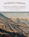
San Francisco Lithographer: African American Artist Grafton Tyler Brown
(The Charles M. Russell Center Series on Art and Photography of the American West)
Robert J. Chandler, Ph.D., Shirley AnnWilson Moore, Ron Tyler, PhD.
Grafton Tyler Brown—whose heritage was likely one-eighth African American—finessed his way through San Francisco society by passing for white. Working in an environment hostile to African American achievement, Brown became a successful commercial artist and businessman in the rough-and-tumble gold rush era and the years after the Civil War.Best known for his bird’s-eye cityscapes, he also produced and published maps, charts, and business documents, and he illustrated books, sheet music, advertisements, and labels for cans and other packaging.
The Golden Gazette:
News from the Newspapers of 1848-1857
Dudley T. Ross
"The Golden Gazette," turns out to be a fabulous collection of news stories for anyone curious about the quirky and sometimes frightening episodes of San Francisco's early days: hangings (including women), fires, fleeing criminals, notes on theatrical stars, ship wrecks, ads for things like "Oriental Tooth Wash," wheat crops shipping out of Martinez and Benicia, sheep prices, etc. His selection will please anyone wandering and exploring California.