Maritime Nations
Antarctica
About 350 B.C., the Greeks—who knew about the Arctic (Arktos, the Bear, from the constellation of the Great Bear)— thought that there should be a similar cold Southern landmass in order to balance the world. It would be the opposite of the Arctic, i.e. Ant-Arktos.
Antarctica is the coldest, windiest, driest continent and holds the record for the world's lowest temperature (-128 degrees F).
In January of 1773, James Cook crossed the Antarctic circle and circumnavigated Antarctica. Although he did not sight land, rock deposited in icebergs confirmed that a southern continent existed.
However, it was not until 1820s when a Russian Naval Officer circumnavigated the Antarctic and made a sighting of the continent at 69° 21°S, 2° 14°W and described an "ice field covered with small hillocks." He was followed by British and American commercial operators and British national expeditions began exploring the Antarctic Peninsula region and other areas south of the Antarctic Circle.
The Endurance. Underwood & Underwood.

In 1821, Captain John Davis, an American sealer, is credited by some as being the first person to land. In the winter of 1821, an officer and ten men aboard Lord Melville, a British sealing ship had to spend the winter on King George Island—part of the South Shetlands group, north of the Antarctic Peninsula. The ship had been driven offshore and did not return to pick them up again. They were rescued the following summer.
Not until 1840 was it established that Antarctica was indeed a continent and not just a group of islands by British naval officer and scientist James Clark Ross . . . his two ships, the Erebus and the Terror, were within 80 miles of the coast, but were stopped by a massive ice barrier. He also discovered the active volcano that he named after his ship Erebus. His ship scientist identified 145 new species of fish.
Through the years, seven countries have made territorial claims on the island, but not all countries recognize the claims. They include Australia, Chile, and Argentina.
August 12, 1876, Iron, London, United Kingdom
SCIENCE AT SOUTH KENSINGTON.
On Saturday evening, last week, Captain Davis, R. N., of the Hydrographic Department of the Admiralty, gave the free lecture, Major Festing, R. E., being in the chair. The subject was "Antarctic Discovery," in sequence to the lecture on "Arctic Discovery," given by Captain Davis the previous Saturday. The scope of the lecture was to explain the Antarctic charts and maps exhibited in the collection, many of which are contributed by Captain Davis, who went with Captain Ross's expedition in 1839.
The lecturer began with remarking that though the names of the Arctic heroes, Parry, Franklin, Ross, &c, were familiar as household words, comparatively few had ever heard even of the Antarctic explorers Bellingshausen, Weddel, Blscoe or Balleny, while Cook was more remembered for his discoveries in the Pacific than for his old pushing to the south and sailing for 500 miles within the Antarctic Circle.
The coming transit of Venus in 1882 again drew attention to the Antarctic Circle, since, by one of the methods of observing it could be best done in a high southern latitude. Captain Davis gave a brief history of the different expeditions to the Antarctic Circle, beginning with the earliest in 1599 attempted by five Dutch ships from Rotterdam. Weddel, in 1822, on a sealing expedition, went as far as L15, which was 185 miles further south than any navigator that preceded him. In 1837, much attention was given to the subject of terrestrial magnetism. Gauss urged the importance of observations at widely-separated stations, and at the instigation of the British Association and the Royal Society the Government of the day sent out Captain Ross (the discoverer of the north magnetic pole) with the Erebus and Terror, to learn what could be learnt of the south magnetic pole. Captain Davis described this expedition, of which he was a member, and which he had illustrated by many water-colour pictures. The highest point reached was 78 4, within 160 miles of the magnetic pole. Wilkes' American expedition was criticised at considerable length, the "appearances of land" mapped being often delusions. This has been in many cases proved by Ross' two last voyages and by the Challenger. Captain Davis much doubts whether any one will ever get nearer the pole than Ross did.
March 25, 1896, Oakland Tribune, Oakland, California, U.S.A.
Carsten Borchgrevink (1864-1934), the Norwegian explorer, claims that the continent he calls Antarctica covers four million square miles, and he values his discovery upon the theory that as a continent, it can be colonized. He believes the area around the south magnetic pole Is charged with electricity: that the place is habitable, and that the Eskimo could live there as well as he could in Greenland. He goes so far to say that there is enough electricity stored in the soil and air of Antarctica to furnish all the heat and light that may be required by the future nation, and asserts that it will be comparatively easy for science to alter the climatic conditions of the country at will.
September 22, 1897, Logansport Pharos, Logansport, Indiana
Antarctica.
That is the name which has been given to the supposed continent around the south pole. It is by no means certain that there is such a continent around the south pole, but explorers believe there is.
At different times whalers in the south seas and others have touched upon the borders of what seemed to be a great continent. Its coast on the eastern hemisphere projects as far north as about 63 degrees south latitude, abruptly receding till its edge is as near the south pole as 79 degrees south latitude. It is in this latitude, longitude 170 degrees east, that Mount Erebus and Mount Terror are situated. Erebus is an active volcano, and, if they come into its neighborhood, will furnish heat enough to warm the explorers who this summer steamed away to the south pole on the vessel Belgica, sent out by the Belgian government. The Belgica will explore Graham Land, the part of the Antarctic continent lying directly south of South America. A commercial expedition from the United States will
in the next year attempt to explore the great continent, too, and see what can be made of it. This will proceed in a line south of Cape Horn. Meantime from the other side of the world, south of Africa, a German scientific party will approach the antarctic land next year. Thus there will be three parties endeavoring to penetrate the mystery of the frozen south. If there is land all the way to the south pole, the entire journey might perhaps be made with sledges and dogs. It may be that while there is nothing but water around the north pole, the south pole is surrounded by land.
February 7, 1895, San Francisco Call,, San Francisco, California, U.S.A.
THE PENGUINS.
They Waddle on Land but are Active in the Water

The appearance of the keeper with his pail of live gudgeon is the signal for sudden and intense excitement in the cages. The penguins wave their little flippers and waddle to the door, whence they peer eagerly down the wooden steps leading to the pool. The cormorant croaks and sways from side to side, and the darters poise their snaky heads and spread their batlike wings. At the water's edge the penguins do not launch themselves upon the surface like other water fowl, but instantly plunge beneath.
Once below the water an astonishing change takes place. The slow, ungainly bird is transformed into a swift and brilliant creature, beaded with globules of quicksilver where the air clings to the close feathers, and flying through the clear and waveless depths with arrowy speed and powers of turning far greater than in any known form of aerial flight. The rapid and steady strokes of the wings are exactly similar to those of the air birds, while its feet float straight out level with the body--unused for propulsion or even as rudders, and as little needed in its progress as those of a wild duck when on the wing.
The twists and turns necessary to follow the active little fish are made wholly by the strokes of one wing and the cessation of movement of the other, and the fish are chased, caught and swallowed without the slightest relaxation of speed in a submarine flight which is quite as rapid as that of most birds which take their prey in midair. In less than two minutes some thirty gudgeon are caught and swallowed below water, the only appearance of the birds on the surface being made by one or two bounds from the depths, when the head and shoulders leap above the surface for a second and then disappear.
Any attempt to remain on the surface leads to ludicrous splashing and confusion, for the submarine bird cannot float; it can only fly below the surface. Immediately the meal is finished, both penguins scramble out of the water and shuffle with round backs and drooping wings to dry and digest.
Condon Spectator.
September 12, 1901, Los Angeles Herald, Los Angeles, California, U.S.A.
LIEUT. SHACKELTON AS TALKER
People whom Lieut Shackelton casually meets must be a trial to him with their trivial questions, but he has a merry wit. He was explaining how the penguins set up nest keeping. Mr. Penguin would feed his wife as she sat on the eggs. He brought her prawns and the like, carrying them in his gullet, into which she dipped her beak. "Are the birds monogamic" asked the naturalist present. "That we could not determine," replied the Great Iceman. "We frequently saw a male penguin feed another bird's wife, but we could not say whether his motives were absolutely disinterested."
1899. World's Fleet. Boston Daily Globe
Lloyds Register of Shipping gives the entire fleet of the world as 28,180 steamers and sailing vessels, with a total tonnage of 27,673,628, of which 39 perent are British.
| Great Britain | 10,990 vessels, total tonnage of 10,792,714 |
| United States | 3,010 vessels, total tonnage of 2,405,887 |
| Norway | 2,528 vessels, tonnage of 1,604,230 |
| Germany | 1,676 vessels, with a tonnage of 2,453,334, in which are included her particularly large ships. |
| Sweden | 1,408 vessels with a tonnage of 643, 527 |
| Italy | 1,150 vessels |
| France | 1,182 vessels |
For Historical Comparison
Top 10 Maritime Nations Ranked by Value (2017)
| Country | # of Vessels | Gross Tonnage (m) |
Total Value (USDbn) |
|
|---|---|---|---|---|
| 1 | Greece | 4,453 | 206.47 | $88.0 |
| 2 | Japan | 4,317 | 150.26 | $79.8 |
| 3 | China | 4,938 | 159.71 | $71.7 |
| 4 | USA | 2,399 | 55.92 | $46.5 |
| 5 | Singapore | 2,662 | 64.03 | $41.7 |
| 6 | Norway | 1,668 | 39.68 | $41.1 |
| 7 | Germany | 2,923 | 81.17 | $30.3 |
| 8 | UK | 883 | 28.78 | $24.3 |
| 9 | Denmark | 1,040 | 36.17 | $23.4 |
| 10 | South Korea | 1,484 | 49.88 | $20.1 |
| Total | 26,767 | 87.21 | $466.9 | |

Site Search

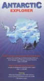
Antarctic Explorer Map
Nigel Sitwell
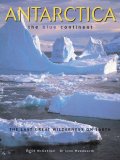
Antarctica: The Blue Continent
David McGonigal
The Discovery of the South Shetland Islands: The Voyages of the Brig Williams 1819-1820
As Recorded in Contemporary Documents and the Journal of Midshipman.
(The Hakluyt Society, Third Series)
Editors: R. J. Campbell, C. W. Poynter