Canada
° British Columbia (Vancouver and Vancouver Island)
° Edmonton ° Halifax
° Hudson Bay
° Manitoba
° Montreal
° Newfoundland and Labrador (St. John's)
° Ontario
° Ottowa
° Quebec
° Regina ° Toronto ° Winnipeg
° The Maritime Provinces: New Brunswick and Nova Scotia
Montreal
The geography of Canada is vast and diverse. Occupying most of the northern portion (precisely 41%) of the continent of North America, Canada is the world's second largest country in total area after Russia.

Canada spans an immense territory between the Pacific Ocean to the west and the Atlantic Ocean to the east (hence the country's motto), with the United States to the south (contiguous United States) and northwest (Alaska), and the Arctic Ocean to the north; Greenland is to the northeast.
Off the southern coast of Newfoundland lies Saint-Pierre and Miquelon, an overseas community of France.
December 8, 1882, Winnipeg Free Press, Winnipeg, Manitoba, Canada
IMMIGRATION RETURNS
Montreal Gazette
The immigration into the Dominion in the current year will largely exceed any previously reported. In the ten months ending October 31st there arrived in Canada 153,055 immigrants, of whom 82,482 or rather more than one-half have settled in this country; that is to say, our population has been reinforced from aboard at the rate of 8,240 persons per month during this year.

The figures for British Columbia, and the return of the number who entered the Northwest by the American frontier between Emerson, and Fort Benton are not included in these figures, but estimating this increment to be as large as last year, it is safe to anticipate that the full returns for the year will show an addition of one hundred thousand to our population by immigration. That result is eminently satisfactory. It is especially so when we know that of late the stream of immigration from the Old World has been about stationary, that the United States returns are now falling behind those of last year, and that in that couintry our chief competitor for the surplus population of Europe, the volume of immigration in 1882 will not exceed that of 1881. Compared with former years the gain of population which we are now makng is remarkable . . .
The money value of our population is in itself an enormous item. The amount of money and effects bought by immigrants last year was ascertained to be $4,188,025, and this year the amount so introduced into Canada will be something like ten million dollars. We owe the great impetus to immigration in the past two years primarily to the opening up of the Northwest, the advantages of which are now becoming understood and appreciated in Great Britain. The tide of travel in that direction should be unabated many years to come.
Canada 1881.

It has taken a long time to get our due proportion of the Old World emigration, jut at last we have fairly turned a large stream to Canada, and the advantages of our position ought now to enable us to push steadily forward in the competition with the United States.
Since 1925, Canada has claimed the portion of the Arctic between 60 W and 141 W longitude to the North Pole; however, this claim is not universally recognized. Covering 9,984,670 km or 3,855,103 square miles (Land: 9,093,507 km or 3,511,023 mi; Water: 891,163 km or 344,080 mi), Canada is slightly less than three-fifths as large as Russia, less than 1.3 times larger than Australia though slightly smaller than Europe, and more than 40.9 times larger than the UK. In total area, Canada is slightly larger than the US and (both in turn) China; however, Canada is somewhat smaller than both in land area (China is 9,596,960 km / 3,705,407 mi and the US is 9,161,923 km / 3,537,438 mi), ranking fourth.
Canadian Forces Station (CFS)
The northernmost settlement in Canada (and in the world) is Canadian Forces Station (CFS) Alert (just north of Alert, Nunavut) on the northern tip of Ellesmere Island latitude 82.5 N just 834 kilometres (518 mi) from the North Pole. The magnetic North Pole lies within Canadian boundaries; however, recent measurements indicate it is moving towards Siberia.
Allan Line Royal Mail Triple Screw SteamerMarch 27, 1891, Daily Alta California A STEAMSHIP PROJECT.
 Montreal, March 26th. Montague Allan and J. S. Allan of the Allan Steamship Line have arrived in England on business connected with a new steamship project. It ia proposed to form a new company, of which the Naval Construction and Armament Company of Barrow-in-Furness (Cumbria, Great Britain) and the Allan Company will be the chief promoters. Negotiations between the two companies are at present in progress, and they are expected to be successful. The intention is to have the new company take over the existing Allan line of steamers and ran them principally as freight steamers. The new line will be under the control of the Allans and be neutral as between the Grand Trunk and Canadian Pacific railways. The new company is working to secure a Government subsidy. Three or four fast steamers will be built similar to those running to New York, and it is expected traffic to and from Chicago and the Northwest will thus be diverted toward Montreal. Montreal will be the summer port and either Halifax or St. John the winter port. THE STATE LINE SOLD. Glasgow, March 26th. The Allan Steamship Company has purchased the State Line's vessels and the good will of the company. |
1899. World's Fleet. Boston Daily Globe
Lloyds Register of Shipping gives the entire fleet of the world as 28,180 steamers and sailing vessels, with a total tonnage of 27,673,628, of which 39 perent are British.
| Great Britain | 10,990 vessels, total tonnage of 10,792,714 |
| United States | 3,010 vessels, total tonnage of 2,405,887 |
| Norway | 2,528 vessels, tonnage of 1,604,230 |
| Germany | 1,676 vessels, with a tonnage of 2,453,334, in which are included her particularly large ships. |
| Sweden | 1,408 vessels with a tonnage of 643, 527 |
| Italy | 1,150 vessels |
| France | 1,182 vessels |
For Historical Comparison
Top 10 Maritime Nations Ranked by Value (2017)
| Country | # of Vessels | Gross Tonnage (m) |
Total Value (USDbn) |
|
|---|---|---|---|---|
| 1 | Greece | 4,453 | 206.47 | $88.0 |
| 2 | Japan | 4,317 | 150.26 | $79.8 |
| 3 | China | 4,938 | 159.71 | $71.7 |
| 4 | USA | 2,399 | 55.92 | $46.5 |
| 5 | Singapore | 2,662 | 64.03 | $41.7 |
| 6 | Norway | 1,668 | 39.68 | $41.1 |
| 7 | Germany | 2,923 | 81.17 | $30.3 |
| 8 | UK | 883 | 28.78 | $24.3 |
| 9 | Denmark | 1,040 | 36.17 | $23.4 |
| 10 | South Korea | 1,484 | 49.88 | $20.1 |
| Total | 26,767 | 87.21 | $466.9 | |

Site Search

Steamboat Connections: Montreal to Upper Canada, 1816-1843
Frank Mackey


Fast Sailing and Copper-Bottomed: Aberdeen Sailing Ships and the Emigrant Scots They Carried to Canada, 1774-1855
Lucille H. Campey
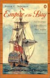
Empire of the Bay:
The Company of Adventurers that Seized a Continent
Peter C. Newman
The Hudson's Bay Company turned much of the upper half of North America into a company town. At one point, the company's territory covered one-twelfth of the earth's surface and was ten times the size of the Holy Roman Empire. It stretched from London, across Canada, to San Francisco, and across the Pacific.
A Great and Noble Scheme:
The Tragic Story of the Expulsion of the French Acadians from Their American Homeland
John Mack Faragher