Canada
° British Columbia (Vancouver and Vancouver Island)
° Edmonton ° Halifax
° Hudson Bay
° Manitoba
° Montreal
° Newfoundland and Labrador (St. John's)
° Ontario
° Ottowa
° Quebec
° Regina ° Toronto ° Winnipeg
° The Maritime Provinces: New Brunswick and Nova Scotia
British Columbia: Vancouver Island
The coasts and interior valleys of British Columbia were first occupied sometime after the last Ice Age. Occupation of some sites in BC has been confirmed by carbon dating at about 6,000 8,000 years ago. The people of the Northwest Coast lived in autonomous villages of 200 to 1,000 people and had access to a particularly bountiful environment that provided abundant shellfish, salmon and even whales. Groups living along the coast used a variety of fishing tools and techniques, and used forest resources to build large and sophisticated plank houses. The coastal people concentrated along the lower reaches of the major salmon rivers. These groups developed an elaborate culture typified by totem poles and the potlatch (see Tagish; Tsimshian; Haida; Tlingit; Kwakiutl; Nootka; and Native People: Northwest Coast).
The interior inhabitants, such as the Carrier, Interior Salish and Kootenay were generally nomadic and depended on hunting. Those groups living in the Subarctic region of the interior generally fished and hunted moose and caribou, while those living in the southern interior had a milder climate. The availability of salmon made it possible for the groups living in the southern interior to winter in small villages.
Captain James Cook of the British Navy reached British Columbia in 1778, followed by Captain James Barkley in 1878 who came in search of sea otter pelts. On April 30, 1792, Captain George Vancouver's exploring expedition on the ship HMS Discovery enter the Strait of Juan de Fuca. To 1795, George Vancouver sailed the Pacific as the captain of his own expedition — and as an agent of imperial ambition. Britain had its eyes on America's Pacific coast.
His voyage was a great feat of maritime daring, discovery, and diplomacy, and his marine survey of Hawaii and the Pacific coast was at its time the most comprehensive ever undertaken. But just two years after returning to Britain, the 40-year-old Vancouver, hounded by critics, shamed by public humiliation at the fists of an aristocratic sailor he had flogged, and blacklisted because of a perceived failure to follow the Admiralty’s directives, died in poverty, nearly forgotten.

During Vancouver's time in the Northwest, he met Spanish explorer Captain Dionisio Galiano in what is now named English Bay.
Due to its distance from the eastern coast of Canada and the barrier to east-west movement created by the mountains, the Pacific Northwest was very difficult for early Europeans to reach and was the last part of North America they explored. The first permanent European settlement came with the development of the fur trade in the early 19th century. A flurry of activity followed the discovery of gold on the lower and middle Fraser River, resulting in an inland system of supply and transportation along the Fraser River to the Cariboo Mountains. By the 1880s more permanent mining towns began to dot the valleys of the southeast each supported by local forestry, small farms and complex rail, road and water transport. In contrast, on the southwest coast settlement was more urban and commercial.
From 1860 to 1890 Victoria, the capital, was the main administrative and commercial settlement, and the supply centre for interior and coastal resource development. Vancouver, on Burrard Inlet north of the mouth of the Fraser River, was selected as the site for the western terminal of the CPR in 1886. Vancouver soon replaced Victoria as the commercial centre and became the main port for both coastal and interior products to move to world markets.

Captain George Vancouver, an English officer of the British Royal Navy, explored the Pacific Ocean from New Zealand and Australia to Hawaii and North America and Canada's Pacific Coast regions between 1791 and 1795. Sailing with two ships, he mapped and surveyed the area that is now downtown Vancouver, giving various parts British names. He returned to his native England little imagining that is less than one hundred years his name would be immortalized in that rugged wilderness. Various cities and regions are named for him: Vancouver Island, the city of Vancouver in Canada and in Washington.
In 1808, following the course of the river that today bears his name, Simon Fraser arrived. He was searching for the Columbia River; once he determined that this was not Columbia and was then confronted by hostile Indians, he turned back in disappointment the same day.
January 13, 1896, Sacramento Daily Union, Sacramento, California, U.S.A.
FATE OF THE JANET COWAN.
Driven Ashore on the West Coast of Vancouver Island.
Terrible Sufferings of Her Crew After Reachiog the Land.
Some of Them Rescued, and Others Died of Exposure—Five Still on the Ice-Bound Short —Street Car Robberies in Portland—( uliibrnians Whoso I.lyes Are In .Jeopardy in South Africa—The Monterey Preparing to Go to Sea.
PORT TOWNSEND (Washington), January 10. The British bark Janet Cowan, Captain Thompson, bound from Cape Town, South Africa, to Vancouver, B. C, was wrecked on December 31st last near Carmanah, on the west coast of Vancouver Island. Directly the ship struck the rocks Second Mate Howell and two apprentice lands named Steele and Logan jumped overboard and perished while endeavoring to reach land, and the brave skiper, together with three of his crew, were frozen to death while endeavoring to find shelter on the rocky shore.
The Janet Cowan was a Clyde-built vessel, owned by Shakland & Co., and valued at $127,000. She left Cape Town September 11th for Vancouver under charter to load lumber for a South African port. Her voyage was uneventful until December 30th, when she rounded Cape Flattery and encountered a heavy gale, which drove her seaward. A succession of adverse winds forced the unfortunate ship towards the dreaded west coast of Vancouver Island and despite all efforts on the part of the crew, she struck a reef abaut twelve miles west of Carmanah lighthouse on the night of December 31st. Directly the vessel grounded Second Mate Howell and two of the crew jumped overboard and perished.
As soon as it became apparent that the ship was doomed the men set about to reach the shore, an extremely difficult task on account of the terrible surf. Finally, after several attempts, a sailor with a rope, and later on a breeches buoy was rigged up on which the remainder of the crew reached the beach in safety. The men were almost entirely nude and the weather was bitterly cold.
The landing was effected at the bottom of a snow-covered cliff, over the top of which lay the only means of escape. A sailor scaled the cliff, and by means of a rope his companions followed him to the table-land above. Here a telegraph line was found, and the party divided, one-half following the wire in either direction.
The little band who faced westward soon encountered a river, which barred further progress in that direction. Retracing their steps, they followed the pole line eastward until they discovered the bodies of Captain Thompson and three sailors frozen stiff and almost covered with snow. Fearing a similar fate, the famished and half-frozen seamen once more headed for their vessel. On reaching the cliff they found the sea much calmer, and securing a lifeboat, which had drifted ashore, the decimated party returned to the ship.
While attempting to prevent the sailors from pilaging the Captain's cabin, the first mate fell through a hatchway and broke his leg. After looting the bark of three months' provisions, the men landed on the beach, where for twelve days they suffered in the snow until the arrival of the tug Tyee yesterday morning. The first mate and thirteen men were brought to this city to-day, and are now in charge of the British Consul. All are more or less frost-bitten.
The remaining five of the crew were on the top of the bluff when the rescue was effected, and either refused to leave or could not understand the signals from the tugboat, A rising storm forced the Tyee to leave them to their fate, and it is possible they all may perish from exposure. A vessel will be sent to their relief immediately.
The fourteen survivors now in Port Townsend are: First Mate Legnell and Sailors Hunt, Moran, Smyth, Olsen, Kerr, Cox, Chamberlain. Cumberliss. Cousin, Heath, Rosario, Carpenter and Wilson.
May 27, 1899, Sausalito News, Sausalito, California, U.S.A.
CHINESE FORM A BIG TRUST.
Oriental Merchants at Work on the Scheme.

Vancouver, B. C. Some of the most influential Oriental merchants are now working on a scheme which is simply gigantic in its scope and one which undoubtedly will attract attention in all parts of the American continent. It is to form companies in every city of consequence in the United States, Canada and Australia, which will attempt to control Chinese capital in order to promote and control Oriental industries.
When Kang, the Chinese reformer, was in Vancouver, he outlined the scheme to a number of prominent Chinese and his ideas were quickly acted upon. Interpreter Cum Yow, who is in the scheme, said in regard to it:
"We have no doubts about its success. Our plan is to give the Chinese a chance to invest their money in this country and to further all Chinese industries. There are at present 5,000,000 Chinese in Canada, Australia and the United States, and they will all, we think, go into the scheme. As soon as our company is formed there we will send out our agents and form companies in every city of any size in Canada, the United States and Australia. We expect to issue altogether about $60,000,000 worth of stock. With the formation of the companies accomplished and the stock issued they will be brought under one management with headquarters possibly in Vancouver. Then a Banking institution will be formed and investments in Chinese Industries will be made on an immense scale. Shares of the immense trust will sell at $1 each, and already several thousand dollars' worth have been bought here by men who are making only $1 a day."
The promoters, who are nearly all Wealthy men, are: Yip Sang, Hip Tuck Lung, Charlie Yip Yen, Sum Kee, Dr. Lui, Lee Yuen and W. A. Cum Yow.
Kang, the Chinese reformer and refugee, who originated the scheme, is said to have invented a quarter of a million in it.
Chinatown is much excited over the project and every Celestial in the city is said to be eager to purchase stock. The whole concern is simply an immense trust, although the promoters are loth to acknowledge it.
Operations of the trust will not be confined to Chinese Industries, as it proposed to build steamers to run to China and possibly construct a railway line in Mexico.
Fort Vancouver
The area was opened by overland explorations.
In 1825, the Hudson's Bay Company opened Fort Vancouver on a bluff above the north bank of the Columbia River. At the time, it was thought that the north bank, which is now Vancouver, Washington, would be the border between Canada and the U.S.
In 1836, the Beaver the first steamship to reach the Pacific Ocean arrived from England.

The growth by white settlers was spurred by the discovery of gold at Fraser Canyon in British Columbia in 1856. Approximately 25,000 prospectors arrived from world ports. Then in 1870, Billy Barker found gold at Williams Creek, and by 1870, more than 100,000 traveled to Barkerville, which, for a time, was the largest town in western Canada.
Settlements grew mainly to the East in Fort Langley and New Westminster, until about the mid 1860s, when the lumber mills at Granville caught the eye of "Gassy" Jack Deighton. He set up saloon in what is know as Gastown. Around the same time, John Martin, William Hailstone and Samuel Brighouse preempted 550 acres of land adjoining Burrard Inlet at a price equivalent to $1.01 per acre with a view toward becoming brick makers. Because they purchased land so far from developments, they were laughingly dubbed "Three Greenhornes." Today, that land comprises the whole of Vancouver's West End.
During this time, native groups began producing dogfish oil, dried halibut and salmon for the growing immigrant population.
With the completion of the railroad in 1887, shipping increased to meet the railroad and Vancouver soon became Canada's main West coast seaport. Coast forest and fishing resources were exploited by white settlers and a prosperous export lumber trade developed. At the turn of the century, salmon, halibut, cod and herring triggered a growing fishing industry. Canneries, fish buyers and processing plants were established throughout coastal areas.
The west coast of Vancouver Island also developed a history of shipwrecks . . . since 1803, more than 240 ships wrecked along that coastline.
Mayne Island
Mayne Island is located in the southern Gulf Islands, between Vancouver Island and the mainland of British Columbia. Captain George Richards of the Royal Navy surveyed the area aboard his vessel HMS Plumper in 1857, naming the island after his lieutenant, Richard Charles Mayne.
During the Cariboo and Fraser River Gold Rush of the mid-1800s, Vancouver Island miners gathered on Mayne Island before rowing across Georgia Strait to the mainland of BC in search of their fortunes. The earliest homesteaders registered land claims in the Miners Bay area in 1859.
The Fraser River
October 14, 1858, Daily Alta California, San Francisco, California, U.S.A.
Our Special Fraser River Correspondence.
VICTORIA, Oct. 8, 1858.
Returned Miners.
There are now more than a thousand miners in Victoria intending to leave for California as soon as they can obtain a passage. Many of them are in want, and tell the gloomiest tales of the mines, and what they saw and did there. Numbers are from the upper Fraser, where they gave the mines a fair trial, but could scarcely make expenses, or in most instances got nothing. It is one general complaint of a wild, dreary country, and only profitable for gold digging below and in the vicinity of Fort Yale. To record the thousand-and-one narratives, would be but to repeat, in substance, what I have already stated in recent letters.
License Money.
About one hundred of the returned miners have applied to the authorities to have their license money (five dollars) refunded. It is said that this application has been made on the strength of a promise publicly made by the Governor at Fort Hope, that those who could show that they had not worked in the mines should have their money returned. The claims are first certified to before a notary public, and then presented to Mr. Nugent, the Commissioner, who will take what action is necessary in the matter.
Gold Stories About Queen Charlotte's Island
A week ago a canoe arrived at this port from Queen Charlotte's Island, with some startling reports respecting the gold diggings thereabouts.
It is not improbable that quite an excitement will spring up next year respecting Queen Charlotte's Island; but not this winter, as the trip is not an inviting one during the cold weather. In the spring of 1852, an expedition was fitted out from San Francisco, lured by the accounts received from that island, to the effect that gold had been discovered there. The schooner Susan Sturgis, Capt. Rooney, with thirty-five adventurers, arrived at Mitchell's Harbor, on the western coast of the island. There they landed, and remained a month or six weeks, but did not prospect to any great extent, probably for fear of the Indians, who justly have the reputation of being extremely savage and warlike.

At last, most of the party growing dissatisfied, all but eight returned, who were to await the return of the schooner with supplies. She sailed, and in due time returned, to find those who had remained quite disheartened. They accordingly embarked, and determined to take a cruise around the island and trade with the Indians, before returning to California. While thus engaged, the vessel was boarded by a large number of the savages, with apparently friendly intentions, but who, in an unguarded moment, took possession of her, and made slaves of the expeditionists. They were fortunate in not sharing the fate of Jewett's companions at Nootka Sound, in 1804, as recorded in his celebrated narrative. The Indians at last sold their captives to the Hudson's Bay Company, for goods amounting in value to about $30 to each man, and the Company, in thus ransoming them, performed one of its few charitable actions. The schooner was burned and pulled to pieces by the Indians, for her iron work, which they highly prize.

This is the only expedition known to have been undertaken to Queen Charlotte Island, and its unfortunate termination discouraged all further attempts. Since the Fraser river fever, the subject has again come into prominence. Specimens of rich quartz have been exhibited from there, which were said to have been thrown out at a single blast of gunpowder, near the beach, &c. The arrival thence, to which I have above referred, has caused some of the more excitable to contemplate a formal mining expedition next year.
My informant states that the H. B. steamer Beaver is now trading on that coast, and that they careful|y conceal all their knowledge of the island and its resources. It is situated about a hundred miles northwest of Vancouver Island, and lying to the mainland in a similar relative position. So fierce and treacherous are the Indians, that, in trading with them, the trafficking is done through a port-hole, from which a narrow passage way communicates with the shore. Only a few Indians can approach at a time, who make their bargains, select their goods in exchange, and when satisfied, return to make room for others. There are now shown in town a number of fine specimens of gold quartz, silver ore, and bismuth, said to have been brought from thence, and probably were. People, however, are getting shy of everything in the shape of a gold story, and who can blame them?
PRESENTATION OF CREDENTIALS.
Mr. Nugent has presented his credentials, and has had repeated interviews with the Governor. It is stated that he intends entering a protest against the per cent, ad Valorum duty on merchandise levied by the government. Mr. Nugent declined any public reception. W. V. W.
September 29, 1873, Morning Oregonian, Portland, Oregon, U.S.A.
LETTER FROM CARIBOO
. . . The suspension bridge crossing the Fraser river, thirteen miles above Yale, is one of great beauty and strength. The span is 200 feet, the elevation is a hundred feet above the bed of the river, and the water of the river is more than a hundred feet deep. The bridge was built as a private enterprise by the present Lieutenant-Governor, at a cost of $50,000, for which he got from the Government, the exclusive right to levy tolls for seven years, by which he realized a large amount.
Salmon Fishing on the Frazer River,
British Columbia

The Fraser and Thompson rivers have their rise in the Rocky Mountains, the former is 900 miles long, and the latter about 500 miles, and have forced their way through the Cascade range. This range of mountains is distinguished for its valuable bunch grass and raising fine stock. The cattle raised on the upper part of the Cascade range are remarkable for their size, the tenderness and delicious flavor of the meat, the same is applicable to sheep and mutton. In no part of the United States can finer meat be had than that raised in the upper part of the Cascade range. This business has been very profitable, at present it is depressed; the supply exceeds the demand, and prices are reduced from a third to a half of last year's notes.
 |
| Native American Encampment Fraser River, 1882 |
From the mouth of the Fraser river to the head of the valley of Thompson river, Lilloet Clinton, and the 150 Mile House, are bottomlands and prairies of fine agricultural land, and as productive soil as the average of the best part of the Willamette Valley, and more parts equal to its choicest farms. On the lower Fraser, such fruits as applies, pear and plums are raised in large quantities and great perfection. Notwithstanding the large quantity and fine quality of fruit raised there, the people of Victoria prefer importing their fruit from San Francisco. "Far off birds have fine feathers."
MINING

The banks of the Fraser river afford striking evidence of the extensive mining carried on there when the great rush took place in 1858-9. From 1858 to 1862, there were not less than $10,000,000 gold taken out of the Fraser, its banks and tributaries. There is still some mining carried on there but it is primarily by Chinamen who are satisfied with small earnings. The discovery of gold in the Cariboo district in 1861-2, caused another great "rush" to Williams Creek, which proved one of the richest diggings, for the extent of it in modern times. From 1862 to 1864, there were 7,000 of a population on a portion of that creek, not exceeding four miles in length. From 1862 to this date, a period of eleven years, more than $15,000,000 of gold have been taken out of that famous creek and its tributary creeks and gulches. The surface diggings on that creek are comparatively exhausted and deep sinking has been resorted to since 1868.

There are five or six of such claims still paying; and several hydraulic claims on the upper end of the creek, in successful operation. There is little doubt, in the minds of many intelligent miners, that there will be a large amount of gold taken out of Williams Creek, as soon as strong companies are organized that can put up machinery sufficiently powerful to control the water.
Active Pass Light Station was lit for the first time in 1885 by the light's first keeper, Henry "Scotty" Georgeson. Within two months he wrote to his superior requesting a fog horn. A bell was later installed, followed by a fog horn. Scotty's son, George, later became his assistant.
Brokering Belonging
Chinese in Canada's Exclusion Era, 1885-1945
Lisa Rose MarTraces several generations of Chinese "brokers," ethnic leaders who acted as intermediaries between the Chinese and Anglo worlds of Canada.
Before World War II, most Chinese could not vote and many were illegal immigrants, so brokers played informal but necessary roles as representatives to the larger society.

Lisa Rose Mar's study of Chinatown leaders shows how politics helped establish North America's first major group of illegal immigrants. Drawing on new Chinese language evidence, her dramatic account of political power struggles over representing Chinese Canadians offers a transnational immigrant view of history, centered in a Pacific World that joins Canada, the United States, China, and the British Empire.
 Granville Street, Vancouver, British Columbia |
1899. World's Fleet. Boston Daily Globe
Lloyds Register of Shipping gives the entire fleet of the world as 28,180 steamers and sailing vessels, with a total tonnage of 27,673,628, of which 39 perent are British.
| Great Britain | 10,990 vessels, total tonnage of 10,792,714 |
| United States | 3,010 vessels, total tonnage of 2,405,887 |
| Norway | 2,528 vessels, tonnage of 1,604,230 |
| Germany | 1,676 vessels, with a tonnage of 2,453,334, in which are included her particularly large ships. |
| Sweden | 1,408 vessels with a tonnage of 643, 527 |
| Italy | 1,150 vessels |
| France | 1,182 vessels |
For Historical Comparison
Top 10 Maritime Nations Ranked by Value (2017)
| Country | # of Vessels | Gross Tonnage (m) |
Total Value (USDbn) |
|
|---|---|---|---|---|
| 1 | Greece | 4,453 | 206.47 | $88.0 |
| 2 | Japan | 4,317 | 150.26 | $79.8 |
| 3 | China | 4,938 | 159.71 | $71.7 |
| 4 | USA | 2,399 | 55.92 | $46.5 |
| 5 | Singapore | 2,662 | 64.03 | $41.7 |
| 6 | Norway | 1,668 | 39.68 | $41.1 |
| 7 | Germany | 2,923 | 81.17 | $30.3 |
| 8 | UK | 883 | 28.78 | $24.3 |
| 9 | Denmark | 1,040 | 36.17 | $23.4 |
| 10 | South Korea | 1,484 | 49.88 | $20.1 |
| Total | 26,767 | 87.21 | $466.9 | |

Site Search

A Voyage Of Discovery To The North Pacific Ocean, And Round The World: In Which The Coast Of North-west America Has Been Carefully Examined And Accurately Surveyed
Scholar's Choice Edition.
George Vancouver.
Kilts on the Coast: The Scots Who Built BC
Jan Peterson.
When the Hudsons Bay Company decided to establish its new Pacific coast headquarters at Fort Victoria on Vancouver Island in 1843, it was one of the last places to be discovered and settled by Europeans in North America.
Scots came to the Island to manage the Companys business in Fort Victoria, engaging in the fur trade and establishing coal-mining ventures around what is now Nanaimo, where black diamonds were found in abundance.
From founding father James Douglas and other high-placed Company men to the humble miners from Orkney and Ayrshire who were brought over on harsh voyages around Cape Horn to work Nanaimos mines, the Scottish influence on the young Colony of Vancouver Island was indelible. The author focuses on events and people who sparked settlement and growth in BCs first Crown Colony over six critical years, 1848 to 1854.

A Journal, Nootka Sound
John R. Jewitt.
Jewitt was one of the surviving crew of the ship Boston, of Boston. Salter, commander, was massacred on 22d of March 1803. The book is interspersed with some account of the natives, their manners and customs.
The West Coast People: The Nootka of Vancouver Island and Cape Flattery
(Special publication / British Columbia Provincial Museum)

Steamboat Connections: Montreal to Upper Canada, 1816-1843
Frank Mackey

Fast Sailing and Copper-Bottomed: Aberdeen Sailing Ships and the Emigrant Scots They Carried to Canada, 1774-1855
Lucille H. Campey
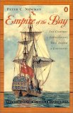
Empire of the Bay:
The Company of Adventurers that Seized a Continent
Peter C. Newman
The Hudson's Bay Company turned much of the upper half of North America into a company town. At one point, the company's territory covered one-twelfth of the earth's surface and was ten times the size of the Holy Roman Empire. It stretched from London, across Canada, to San Francisco, and across the Pacific.
A Great and Noble Scheme:
The Tragic Story of the Expulsion of the French Acadians from Their American Homeland
John Mack Faragher