Sea Captains: San Francisco 1800s
Captain Patterson
Daily Alta California, Tuesday morning, June 14, 1853The Panama papers are filled with remarks upon an alleged cruelty practiced upon a seaman by the officers of the Golden Gate.
We are unable to find what the supposed cruelties were -- the writers on the subject assuming that a terrible thing had been done, without condescending to state what the terrible thing was, and upon that assumption commenting in estenso.
San Francisco Bay. 1899.

From an intimate personal knowledge of the character of Captain Patterson, and the officers under him, we are warranted in saying that he is not amenable to the charge of tyranny, cruelty or unkindness to his passengers or crew, and we cannot credit such a charge without positive proof.
Sea Monsters on Medieval and Renaissance Maps
Chet Van Duzer
From dragons and serpents to many-armed beasts that preyed on ships and sailors alike, sea monsters have terrified mariners across all ages and cultures and have become the subject of many tall tales from the sea. Accounts of these creatures have also inspired cartographers and mapmakers, many of whom began decorating their maps with them to indicate unexplored areas or areas about which little was known. Whether swimming vigorously, gamboling amid the waves, attacking ships, or simply displaying themselves for our appreciation, the sea monsters that appear on medieval and Renaissance maps are fascinating and visually engaging. Yet despite their appeal, these monsters have never received the scholarly attention that they deserve. In Sea Monsters on Medieval and Renaissance Maps, Chet Van Duzer analyzes the most important examples of sea monsters on medieval and Renaissance maps produced in Europe. Van Duzer begins with the earliest mappaemundi on which these monsters appear in the tenth century and continues to the end of the sixteenth century and, along the way, sheds important light on the sources, influences, and methods of the cartographers who drew or painted them. A beautifully designed visual reference work.

The Great Ocean: Pacific Worlds from Captain Cook to the Gold Rush
David Igler
The Pacific of the early eighteenth century was a place of baffling complexity, with 25,000 islands and seemingly endless continental shorelines. But with the voyages of Captain James Cook, global attention turned to the Pacific, and European and American dreams of scientific exploration, trade, and empire grew dramatically. By the time of the California gold rush, the Pacific's many shores were fully integrated into world markets-and world consciousness. The Great Ocean draws on hundreds of documented voyages as a window into the commercial, cultural, and ecological upheavals following Cook's exploits, focusing in particular on the eastern Pacific in the decades between the 1770s and the 1840s. Beginning with the expansion of trade as seen via the travels of William Shaler, captain of the American Brig Lelia Byrd, historian David Igler uncovers a world where voyagers, traders, hunters, and native peoples met one another in episodes often marked by violence and tragedy.

The Sea Chart
The Illustrated History of Nautical Maps and Navigational Charts
John Blake
The sea chart was one of the key tools by which ships of trade, transport and conquest navigated their course across the oceans. John Blake looks at the history and development of the chart and the related nautical map, in both scientific and aesthetic terms, as a means of safe and accurate seaborne navigation. This handsome work contains 150 color illustrations including the earliest charts of the Mediterranean made by thirteenth-century Italian merchant adventurers, as well as eighteenth-century charts that became strategic naval and commercial requirements and led to Cook's voyages in the Pacific, the search for the Northwest Passage, and races to the Arctic and Antarctic.

The Authority to Sail: The History of U.S. Maritime Licenses and Seamen's Papers
Robert Stanley Bates, George Marsh (Editor), John F. Whiteley (Forward) (Batek Marine Publishing, 2011; Nominated in 2012 for a Pulitzer Prize)
This book depicts important aspects of our maritime history as a result of original research done by the author, Commodore Bates, the holder of an unlimited master's license who has enjoyed a distinguished fifty-year career in both the Coast Guard and the American Merchant Marine.
The U.S. Coast Guard issues all Captain Licenses for U.S. Ports.
Note: Other countries have different regulations, i.e. the RYA (Royal Yachting Association), conducts certification for Britain and Ireland. As of 2011, they did not recognize the USCG certification; certification through their courses was required.Master Unlimited is a licensed mariner in ultimate command of a vessel any gross tons. The captain is responsible for its safe and efficient operation, including cargo operations, navigation, crew management and ensuring that the vessel complies with local and international laws. All persons on board, including officers and crew, other shipboard staff members, passengers, guests and pilots, are under the captain's authority and are his or her ultimate responsibility. The STCW defines the Master as Person having command of the ship.
The Sea Chart
The Illustrated History of Nautical Maps and Navigational Charts
John Blake
The sea chart was one of the key tools by which ships of trade, transport and conquest navigated their course across the oceans. Herein is a history and development of the chart and the related nautical map, in both scientific and aesthetic terms, as a means of safe and accurate seaborne navigation. 150 color illustrations including the earliest charts of the Mediterranean made by 13th-century Italian merchant adventurers, as well as 18th-century charts that became strategic naval and commercial requirements and led to Cook's voyages in the Pacific, the search for the Northwest Passage, and races to the Arctic and Antarctic.
Get Your Captain's License. Fifth Edition
Charlie Wing
Considered the quickest, easiest, and least expensive way to prepare for the U.S. Coast Guard captain's ratings exams required for anyone who takes paying passengers on a boat, and useful for serious boaters who want to save money on insurance. 350 pages of seamanship and navigation tutorials. More than 1,500 questions and answers from the Coast Guard exams. Includes an interactive CD-ROM with all 14,000 questions and answers in the USCG database, so you can take an unlimited number of practice exams

Site Search

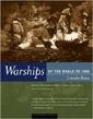
Warships of the World to 1900
Lincoln P. Paine.

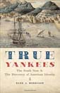
True Yankees: The South Seas and the Discovery of American Identity
(Johns Hopkins University Studies in Historical and Political Science)
Dane A. Morrison
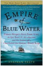
Stephan Talty
Navigation Rules and Regulations Handbook
U.S. Coast Guard
The Navigation Rules & Regulations Handbook supersedes Commandant Instruction M16672.2D This edition includes LNM 39-15 and NTM 41-15 33 CFR 83.01(g) requires: "The operator of each self-propelled vessel 12 meters or more in length shall carry, on board and maintain for ready reference, a copy of these Rules."
American Merchant Ships
1850-1900
Frederick C. Matthews