Sea Captains: San Francisco 1800s
Haley Salisbury
 |
| 1889 Santa Barbara, California |
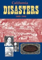
When California became a state in 1850, the newly-establishd City of Santa Barbara interited Pueblo lands and hired Captain Salisbury Haley to survey the town, allotting parcels of land and laying out streets being the purpose of the project.
He hammered an iron stake at the intersection of State and Carrillo streets which officially designated the city's midtown area. One report considers the survey one of the worst - streets were crooked and land lots were of uneven size.
Speculation includes that Haley used a surveying chain that had been mended with hide strips. The hide s expansion and contraction in different weather conditions could have contributed to the survey's inaccuracy.
 An Abstract Chumash Pictograph Originally, the area around Malibu Beach was a Chumash Indian settlement, part of a 17,000 acre Spanish land grant given to Jose Tapia (1776-1802) for 400 pesos, then sold to Mathew Keller for 10 cents an acre and finally to the Rindge family for $10 an acre in 1882. Rindge "didn't want anybody coming here . . . it was fenced, and armed guards were on each end to keep people off because they would poach." |
Another theory proposes that Captain Haley conspired with the local Chumash to point at least one city street at a Chumash shrine in the hills. The city attempted to prevent him from doing this by passing an ordinance which set forth some ground rules for the final layout of Santa Barbara; Haley then broke the law, disregarding this ordinance and making some streets crooked in order to create the desired lines.
In October 1854, the 2500 ton SS Yankee Blade went down off the coast of Southern California.
As Captain Henry Randall approached the rocks near Point Arguello, the steamship was loaded with $1,500,000 worth of gold bullion, 800 passengers and a band of pirates. The ship ran aground in the fog, the pirates took over, loaded two small boats with liquor and loot and abandoned ship. They never reached shore. Not far from the destitute ship, Captain Haley moved slowly through the churning waves as he heard faint cries for help. The rescue operation began. The Goliah sent out a small life-boat to the Yankee Blade. Calling for women and children first, Capt. Haley awaited the first boatload of survivors. To his astonishment, they were not women and children but a group of wild-eyed ruffians who immediately tried to take over the Goliah. With a few sharp blows and swift action, the pirates were soon hustled below deck under lock and key.

(To this day, there is no official record of its recovery. Presumably it lies there still, $1,500,000 worth of gold beneath the sea.)
In the beginning of 1857, San Francisco had a more serious earthquake than any in recent years. At half-past eight on the morning of January 9th, a tremor shook the earth from North to South; the first shocks being light, the quake grew in power until houses were deserted, men, women and children sought refuge in the streets, and horses and cattle broke loose in wild alarm. For perhaps two, or two and a half minutes, the temblor continued and much damage was done.
At Fort Tejon, great rents were opened in the earth and then closed again, piling up a heap or dune of finely-powdered stone and dirt. Large trees were uprooted and hurled down the hillsides; and tumbling after them went the cattle. Until the cracked adobes could be repaired, officers and soldiers lived in tents. A so-called tidal wave almost engulfed the Sea Bird, plying between San Pedro and San Francisco, as she was entering the Golden Gate.
Under the splendid seamanship of Captain Salisbury Haley, however, his little ship weathered the wave, and he was able later to report her awful experience to the scientific world.
September 10, 1858, Daily Alta California, San Francisco
The Pacific Aground in Victoria Harbor.
The Pacific started to leave the wharf at the Old Salmon House in Victoria Harbor, on Sunday, at noon. She had gone only about 100 yards when she found the Wilson G. Hunt lying in the channel, and had to come to anchor. After the Hunt had moved, the Pacific hoisted her anchor and started again, but on coming to the last crook in the harbor, ran upon a mud back, where she stuck. Attempts to back her off by press of steam, assisted by hawsers fastened to trees on shore, proved unavailing.
The steamer Sea Bird, which had been lying near the Salmon House started to assist the Pacific, but ran aground also. Both vessels stuck fast until near midnight, when the Sea Bird got off and then helped the Pacific off. At the time the two steamers ran aground the tide was up, but it was only what is called "half tide," that is, it did not rise so high as the "whole tide," which came at night. The Pacific was under charge of the government pilot, who surveyed the harbor. It will be remembered that the channel of the harbor is very narrow, crooked, and shallow, for large steamers to navigate. The mail steamers will not enter it, and the Constitution tried and got a hole in her bottom.
Capt. Haley says he can enter the harbor safely at high tide, when there are no vessels in the way, and he intends to do so, for the purpose of accomodating the people of Victoria. He attributed her running aground on this occasion to the small headway, caused by stoppage on account of the Hunt, so that his ship would not obey the helm. Fraser River News. -- The Sea Bird and Wilson G. Hunt arrived on Saturday in Victoria from Fraser River, but brought no news of special interest.
 Relief Map of San Francisco Bay Area showing the entrance through the Golden Gate. |
The Sea Chart
The Illustrated History of Nautical Maps and Navigational ChartsJohn Blake
The sea chart was one of the key tools by which ships of trade, transport and conquest navigated their course across the oceans. John Blake looks at the history and development of the chart and the related nautical map, in both scientific and aesthetic terms, as a means of safe and accurate seaborne navigation. This handsome work contains 150 color illustrations including the earliest charts of the Mediterranean made by thirteenth-century Italian merchant adventurers, as well as eighteenth-century charts that became strategic naval and commercial requirements and led to Cook's voyages in the Pacific, the search for the Northwest Passage, and races to the Arctic and Antarctic.

The Authority to Sail: The History of U.S. Maritime Licenses and Seamen's Papers
Robert Stanley Bates, George Marsh (Editor), John F. Whiteley (Forward) (Batek Marine Publishing, 2011; Nominated in 2012 for a Pulitzer Prize)
This book depicts important aspects of our maritime history as a result of original research done by the author, Commodore Bates, the holder of an unlimited master's license who has enjoyed a distinguished fifty-year career in both the Coast Guard and the American Merchant Marine.
The U.S. Coast Guard issues all Captain Licenses for U.S. Ports.
Note: Other countries have different regulations, i.e. the RYA (Royal Yachting Association), conducts certification for Britain and Ireland. As of 2011, they did not recognize the USCG certification; certification through their courses was required.Master Unlimited is a licensed mariner in ultimate command of a vessel any gross tons. The captain is responsible for its safe and efficient operation, including cargo operations, navigation, crew management and ensuring that the vessel complies with local and international laws. All persons on board, including officers and crew, other shipboard staff members, passengers, guests and pilots, are under the captain's authority and are his or her ultimate responsibility. The STCW defines the Master as Person having command of the ship.
The Sea Chart
The Illustrated History of Nautical Maps and Navigational Charts
John Blake
The sea chart was one of the key tools by which ships of trade, transport and conquest navigated their course across the oceans. Herein is a history and development of the chart and the related nautical map, in both scientific and aesthetic terms, as a means of safe and accurate seaborne navigation. 150 color illustrations including the earliest charts of the Mediterranean made by 13th-century Italian merchant adventurers, as well as 18th-century charts that became strategic naval and commercial requirements and led to Cook's voyages in the Pacific, the search for the Northwest Passage, and races to the Arctic and Antarctic.
Get Your Captain's License. Fifth Edition
Charlie Wing
Considered the quickest, easiest, and least expensive way to prepare for the U.S. Coast Guard captain's ratings exams required for anyone who takes paying passengers on a boat, and useful for serious boaters who want to save money on insurance. 350 pages of seamanship and navigation tutorials. More than 1,500 questions and answers from the Coast Guard exams. Includes an interactive CD-ROM with all 14,000 questions and answers in the USCG database, so you can take an unlimited number of practice exams

Site Search

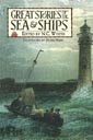
Great Stories of the Sea & Ships
N. C. Wyeth
High-seas adventures showcasing the fiction of classic writers as Daniel Defoe, Jules Verne, and Jack London, but also historic first-person narratives. Tales of heroic naval battles, dangerous journeys, stories of castaways and smugglers, including The Raft of Odysseus, by Homer; Hans Christian Andersen's The Mermaid, Rounding Cape Horn, by Herman Melville.
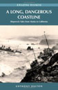
Shipwrecks of the California Coast: Wood to Iron, Sail to Steam
Michael D. White

American Merchant Ships
1850-1900
Frederick C. Matthews