Sea Captains: San Francisco 1800s
H. C. Bunker

Captain H. Bunker, in 1823, discovered an island in 15 30' north, and 136 west longitude. Lying to windward, and it blowing strong, he could not get to it to make any observations.
In the same year he landed on an island in 24 22' north, longitude 153 I8' east, by reckoning, not being able to make an observation that day; nor has he visited or heard of the island since.
Captain H. C. Bunker, about three years ago, discovered an island not on his charts; it is called by the natives Pearotuah, is three miles from east to west, about 20 miles in circumference, high, mountainous, rocky, and rugged, free from all dangers around it, with two boat harbors, one northwest of the other, on the northwest side; the land productive. The missionaries had visited it, and Mr. Williams was on it at the time. The natives are estimated at 5,000 in number. It is in latitude 21 17' south, and longitude 159 40' west. There is no trace of the island on Purdy's charts to the latest editions.
Septemer 6, 1851, Australian and New Zealand Gazette, London, United Kingdom
Auckland Isles.
The Pirates of the "Helen."
Intelligence of the escape of these marauders from Port Ross has just been received in Sydney. Wilson, with another person, supposed to be his mate, shipped at sea on board the whaler Brisk, Captain Bunker.
They stipulated that they should be landed at the first civilised port they might pass on their return from whaling; and Captain Bunker landed them at the Bay of Islands, about the latter end of January last. They were almost starved when they begged to be taken on board the Brisk; and the captain, having his suspicions that all was not right, warned the magistrate of Kororarika. It has since been ascertained, that whatever might have been Captain Bunker's suspicions, his crew were all aware from the beginning who their shipmates were. That the pirates have since escaped from Kororarika there can be but little doubt.
As full information will be sent to the governor of the Auckland Islands, and every other possible step taken to apprehend them, their present escape, it is to he hoped, may be but a temporary one. That they will have the temerity to venture to Sydney is scarcely likely; nevertheless, the water police are on the alert.
The Sea Chart:
The Illustrated History of Nautical Maps and Navigational Charts
 John Blake
The sea chart was one of the key tools by which ships of trade, transport and conquest navigated their course across the oceans. John Blake looks at the history and development of the chart and the related nautical map, in scientific and aesthetic terms, as a means of safe and accurate seaborne navigation. Contains 150 color illustrations including the earliest charts of the Mediterranean made by 13th Century Italian merchant adventurers, as well as 18th Century charts that became strategic naval and commercial requirements and led to Cook's voyages in the Pacific, the search for the Northwest Passage, and races to the Arctic and Antarctic.
Shanghaiing Days: The Thrilling Account of 19th Century Hell-Ships, Bucko Mates and Masters, and Dangerous Ports-Of-Call from San Francisco 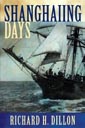
Richard H. Dillon
In the last quarter of the 19th Century, American Merchant Marine went into a decline, and sailors were forced to serve under conditions that were little better than serfdom. Seamen were exploited in wholesale fashion, disfranchised of almost all their civil and human rights, and brutally punished forminor offenses. Successful skippers turned into slave drivers, cracking down on the sailors, sometimes even murdering their "hands." Though captains were legally prohibited from flogging their crews, they did not hesitate to wield belaying pins, marlin spikes, or bare fists. The seamen's lot was so horrible that entire crews jumped ship when in port. New crews were kidnaped, crimped, or shanghaied from the unsuspecting populace of the ports. These "impressed" or "hobo" crews were still further conspired against. They often had their wages stolen from them; they were poorly fed and clothed. Their lives became "hell afloat and purgatory ashore." Our "first and finest employ" in colonial days was turned into a disreputable profession-one that was classed with criminals and prostitutes.
Atlantic: Great Sea Battles, Heroic Discoveries, Titanic Storms, and a Vast Ocean of a Million Stories
Simon Winchester
"Variably genial, cautionary, lyrical, admonitory, terrifying, horrifying and inspiring. A lifetime of thought, travel, reading, imagination and memory inform this affecting account." Kirkus Reviews
Blending history and anecdote, geography and reminiscence, science and exposition, the New York Times bestselling author tells the breathtaking saga of the Atlantic Ocean, setting it against the backdrop of mankind's intellectual evolution. Until a thousand years ago, no humans ventured into the Atlantic or imagined traversing its vast infinity. But once the first daring mariners successfully navigated to far shores whether it was the Vikings, the Irish, the Chinese, Christopher Columbus in the north, or the Portuguese and the Spanish in the south the Atlantic evolved in the world's growing consciousness as an enclosed body of water bounded by the Americas to the West, and by Europe and Africa to the East. Atlantic is a biography of this immense space, of a sea which has defined and determined so much about the lives of the millions who live beside or near its tens of thousands of miles of coast.
The Rebel Raiders
The Astonishing History of the Confederacy's Secret Navy
James T. deKay
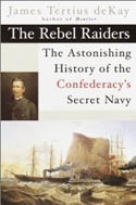
During its construction in Liverpool, the ship was known as Number 290. When it was finally unleashed as the CSS Alabama, the Confederate gunship triggered the last great military campaign of the Civil War, yet another infamous example of British political treachery, and the largest retribution settlement ever negotiated by an international tribunal: $15,500,000 in gold paid by Britain to the United States. This riveting true story of the Anglo-Confederate alliance that led to the creation of a Southern navy illuminates the dramatic and crucial global impact of the American Civil War. Like most things in the War between the States, it started over cotton: Lincoln's naval blockade prevented the South from exporting their prize commodity to England. In response, the Confederacy came up with a plan to divert the North's vessels and open the waterways; a plan that would mean covertly building a navy in Britain with a cast of clandestine characters.
The History of Seafaring: Navigating the World's Oceans
 Donald Johnson and Juha Nurminen
Royal prestige, intellectual curiosity, and territorial expansion all propelled mankind to undertake perilous voyages across unpredictable oceans. This large and lavishly illustrated volume brings that history to life. From the early Phoenician navigation techniques to the technologies behind today's mega-ships, the greatest advances in shipbuilding are covered, accompanied by hundreds of images, with an in-depth look at navigational instruments (including those used by the Vikings).
The Authority to Sail: The History of U.S. Maritime Licenses and Seamen's Papers
Robert Stanley Bates, George Marsh (Editor), John F. Whiteley (Forward) (Batek Marine Publishing, 2011; Nominated in 2012 for a Pulitzer Prize)
This book depicts important aspects of our maritime history as a result of original research done by the author, Commodore Bates, the holder of an unlimited master's license who has enjoyed a distinguished fifty-year career in both the Coast Guard and the American Merchant Marine.
The U.S. Coast Guard issues all Captain Licenses for U.S. Ports.
Note: Other countries have different regulations, i.e. the RYA (Royal Yachting Association), conducts certification for Britain and Ireland. As of 2011, they did not recognize the USCG certification; certification through their courses was required.Master Unlimited is a licensed mariner in ultimate command of a vessel any gross tons. The captain is responsible for its safe and efficient operation, including cargo operations, navigation, crew management and ensuring that the vessel complies with local and international laws. All persons on board, including officers and crew, other shipboard staff members, passengers, guests and pilots, are under the captain's authority and are his or her ultimate responsibility. The STCW defines the Master as Person having command of the ship.
The Sea Chart
The Illustrated History of Nautical Maps and Navigational Charts
John Blake
The sea chart was one of the key tools by which ships of trade, transport and conquest navigated their course across the oceans. Herein is a history and development of the chart and the related nautical map, in both scientific and aesthetic terms, as a means of safe and accurate seaborne navigation. 150 color illustrations including the earliest charts of the Mediterranean made by 13th-century Italian merchant adventurers, as well as 18th-century charts that became strategic naval and commercial requirements and led to Cook's voyages in the Pacific, the search for the Northwest Passage, and races to the Arctic and Antarctic.

Get Your Captain's License. Fifth Edition
Charlie Wing
Considered the quickest, easiest, and least expensive way to prepare for the U.S. Coast Guard captain's ratings exams required for anyone who takes paying passengers on a boat, and useful for serious boaters who want to save money on insurance. 350 pages of seamanship and navigation tutorials. More than 1,500 questions and answers from the Coast Guard exams. Includes an interactive CD-ROM with all 14,000 questions and answers in the USCG database, so you can take an unlimited number of practice exams

Site Search


The Opium War
Through Chinese Eyes
Arthur Waley
Merchant Kings: When Companies Ruled the World, 1600--1900
Stephen R. Brown
Opium: Reality's Dark Dream
Thomas Dormandy